Track Charts - Volume 10, Revision 3 - $10*
>>>>>FINAL REVISION<<<<<
Eastern Railroads Part 3
Land Valuation Maps, Charts and Data
*Now available as a direct download via Dropbox! See main NMRO Products page for details.
Thanks to the efforts of several wonderful individuals, we are again able to offer another great collection of railroad Land Valuation Maps and other highly valuable railroad data. Especially interesting in this release are the valuation and grade charts for the ill-fated Hampden Railroad that was completed but never used. The remainder of the collection consists mostly of material as shown below.
Many more donations have come in from various sources. This has allowed Volume 10 to be increased to over 1200 images. See the list below for examples and sample images.
![]()
What's new in Track Charts Volume 10, Revision 3...?
Barre & Chelsea -
Color coded and black & white charts from 1956 including the quarry district.
B&M RR -
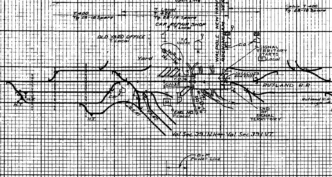
Additional Line Plans for White Mt. Div. Plymouth to Woodsville;
1937 Condensed Profiles from Springfield to Windsor - Extremely clean and highly detailed!;
Brattleboro to Windsor Joint Agreement track profiles for B&M-CV joint trackage agreement of 1935;
1915 (approx) Condensed Profiles from Boston to Rotterdam Jct. - Very detailed in the era of semaphore signalling;
Four new CLEAN replacement pages for the Northern condensed profiles between Concord and Converse;
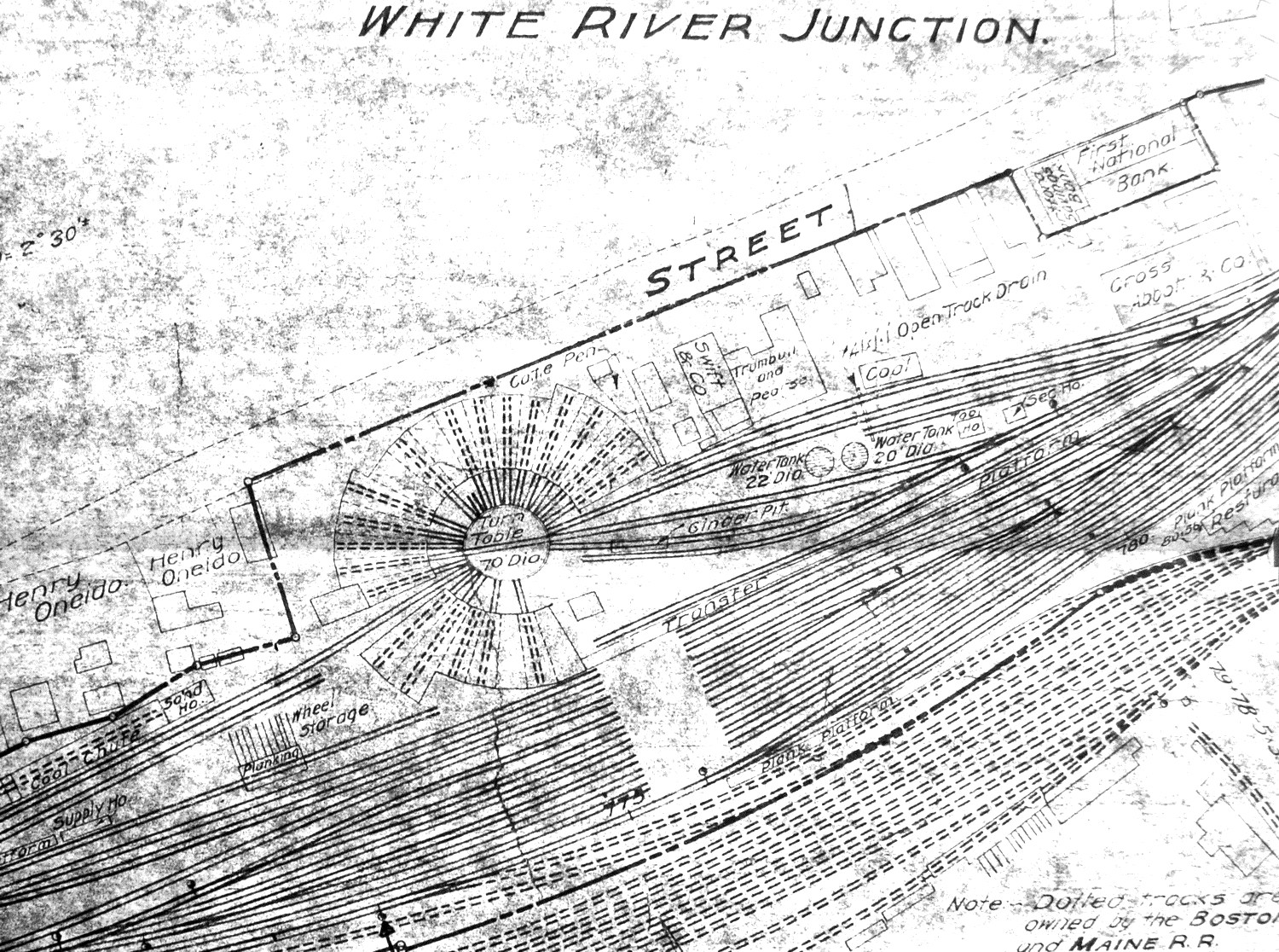
1930 Condensed rofiles from White River Jct to Wells River - Extremely clean and highly detailed!;
1930 Condensed Profiles from Woodsville to Groveton - Extremely clean and highly detailed!;
Baltimore & Ohio -
Monongah Division Branches condensed profiles;
Conrail -
Buffalo Terminal and Niagara Terminal Track Diagrams and Information Books;
East Broad Top -
Complete(?) set of EBT land valuation maps from 1917 - VERY clean drawings!!;
Plus -
Assorted other maps for BAR, C&O, Monon, P&WV
280 total new images!
NMRO is offering ONE (1) compact disk containing 1554 images of land valuation maps, track charts and other drawings.
Also includes the previous releases of:
AMTRAK - New Haven, CT to Springfield, MA Track Charts (22 images);
B&M RR - Numerous sets of line plans from around the system (similar to condensed profiles but more detailed)(400+ images);
B&M RR - A proposed version of CTC on the Connecticut River Route that was not used (22 images);
B&M RR - Claremont Branch signal schematics showing the arrangement for the US&S Style-B semaphores (17 images);
B&M RR - Characteristic Charts sowing various details of items all over the B&M system (29 images);
B&M RR and CV RWY - Land Valuation map segments. Not full maps but shows much detail (330 images);
Delaware & Hudson RR - Rail structure information charts showing details of track hardware used;
Maine Central RR - Improved version of earlier released line plans for much of the MEC (168 images);
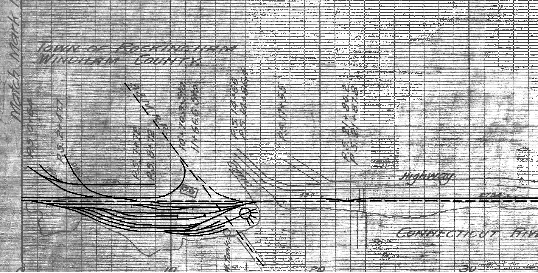
Rutland RR - Bellows Falls Subdivision Track Profiles from 1917 with updates through 1927. VERY interesting (53 images);
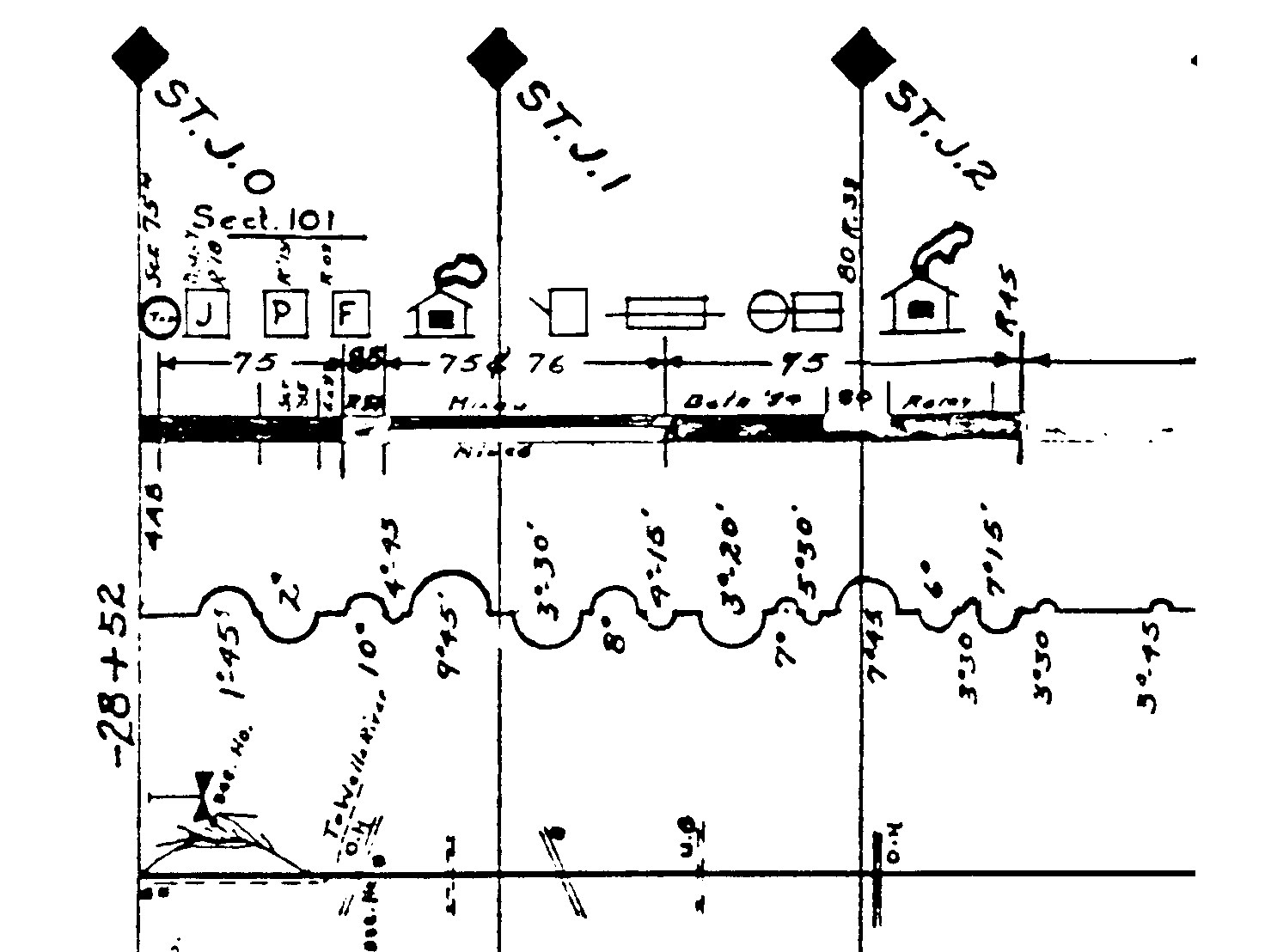
St.J&LC RR - 1953 Condensed Profiles (22 images);
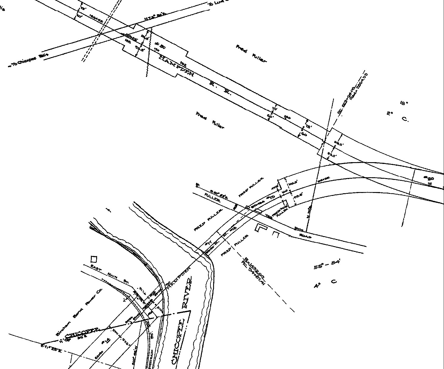
Hampden Railroad - Land Valuation maps of the entire line PLUS the never built line to B&M's Chicopee Falls Branch;
Assorted other east coast railroad goodies from WM (62 images) and B&O railroads;
Virginian RR - Condensed Profiles (30 images);;
Plus many added throughout, more than can be listed here!
Resolution of all images is mostly 2 and 16 color b&w GIF format. If you were to try to obtain these maps anywhere else in paper form it would cost you THOUSANDS of dollars!!! NMRO Products proudly believes that railroad information should be shared as reasonably as possible. Clarification: The data is FREE because it is public domain. NMRO just does the legwork for you.
![]()
East Deerfield - Greenfield condensed profile sample

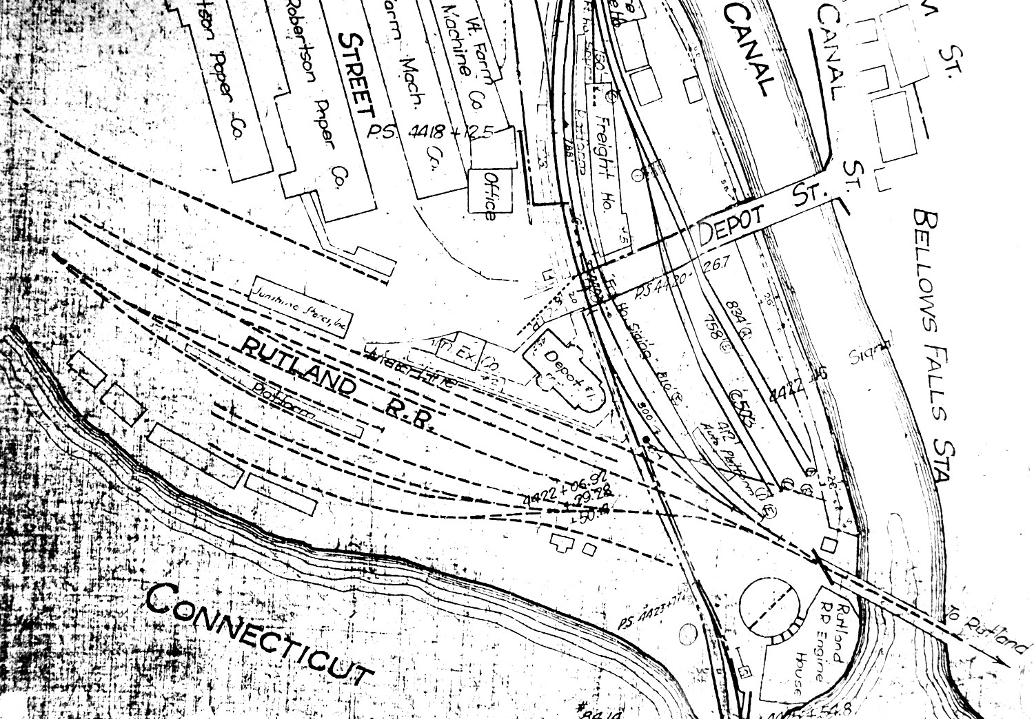
Portion of Boston & Maine - Bellows Falls, VT
(Right click on images and open larger version in a new tab)
Boston & Maine Cheshire Branch Line Plan Sample
Central Vermont Railway Valuation Map Sample
Rutland Railroad Grade & Curve Map Sample
St.J&LC Map Sample
Hampden Railroad Railroad Valuation Map Sample
Order your copy today by mailing $10 + $2 postage to:
Scott J. Whitney
78 Goret Dr.
Colorado Springs, CO 80911
NOTE 1: International mail orders must include $4 additional postage to Canada & Mexico, Total postage $6.
(NOTE 2: ALL International mail orders outside North America must be by Dropbox download only.)
Or use the handy PayPal links below:
![]()
