Track Charts - Volume 13-Rev. 2*
Vermont & New Hampshire Railroad Land Valuation Maps + More!
*Now available as a direct download via Dropbox! See main NMRO Products page for details.
Thanks to the State of VT and efforts of some wonderful individuals, we are again able to offer another great collection of railroad Land Valuation Maps. Featured in this release is a selection of maps from railroads in both Vermont and New Hampshire as well as another round of Track Charts and other general maps from around the country.
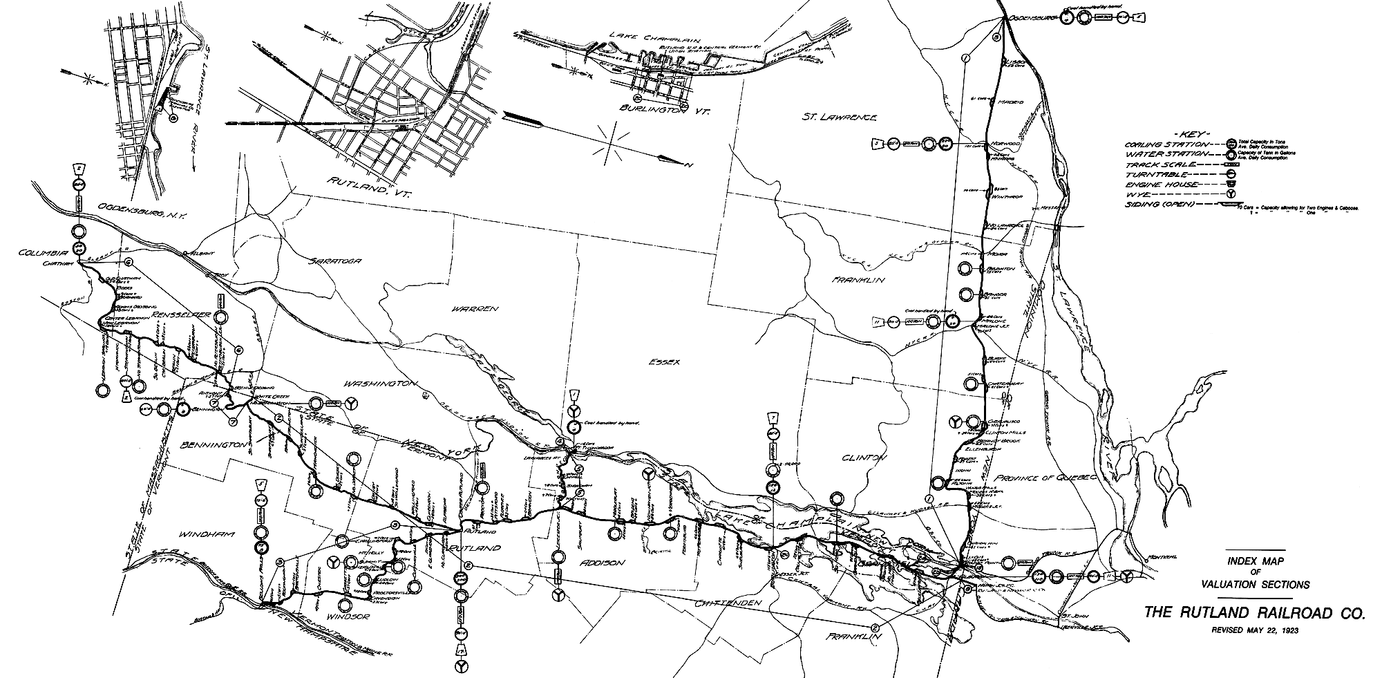
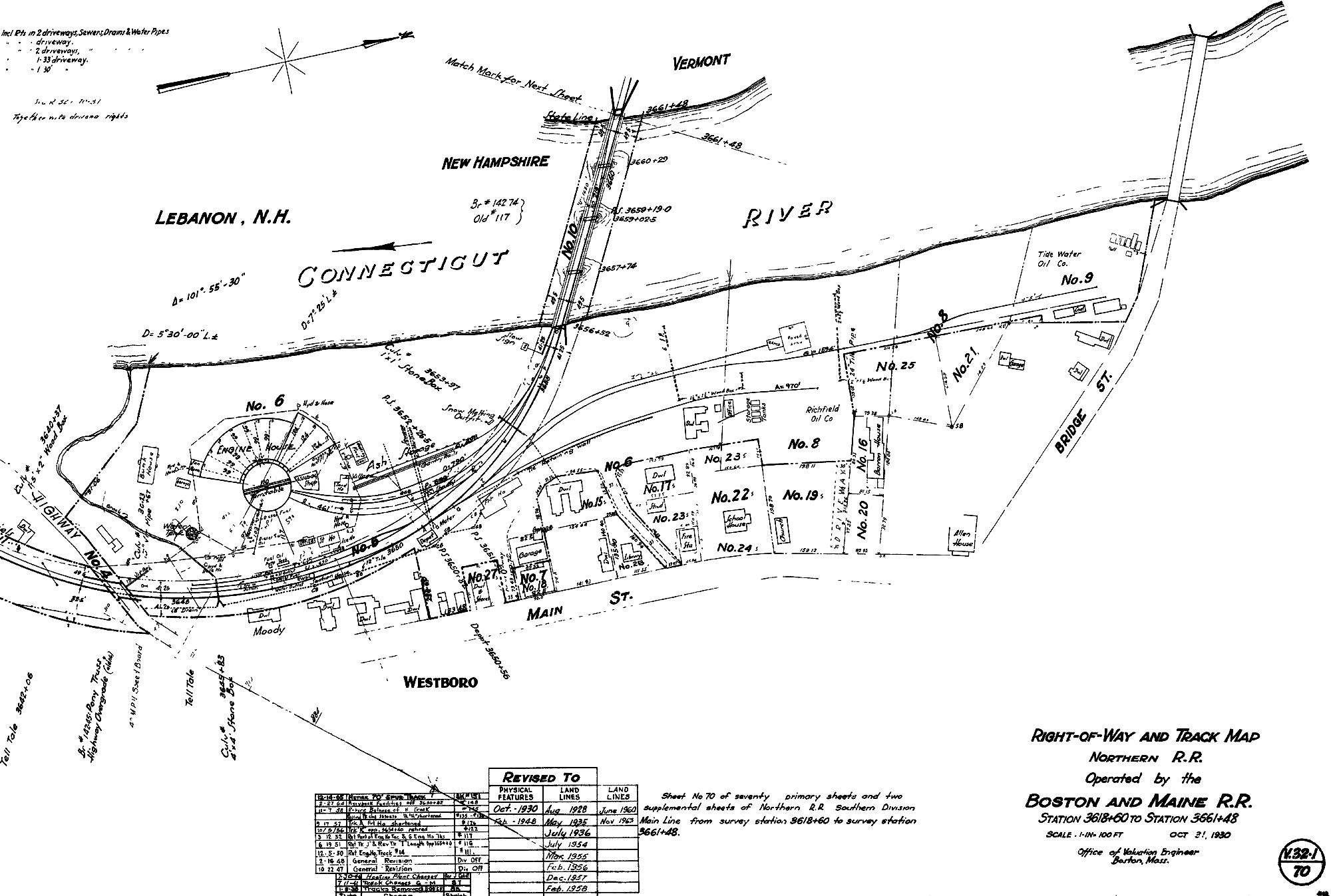
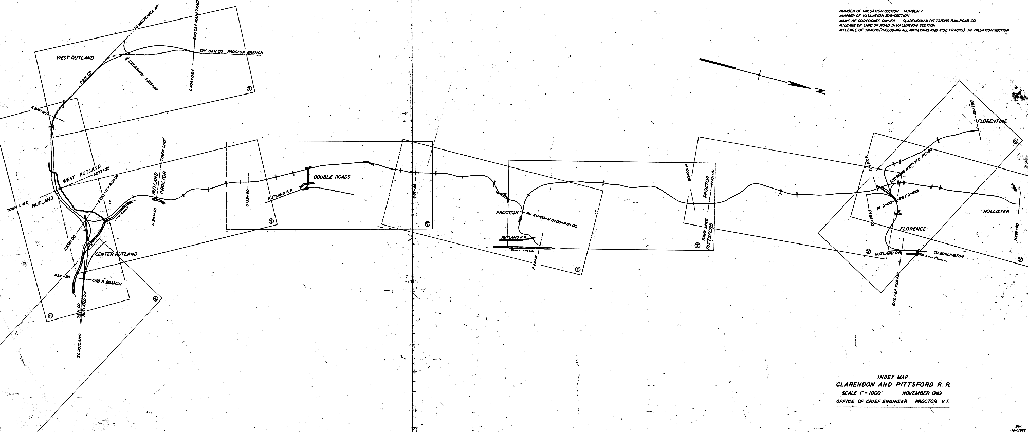
The primary featured railroads of this offering are COMPLETE sets of maps for the following railroads: Rutland Railroad; St. Johnsbury & Lake Champlain Railroad; Montpelier & Wells River Railroad; Barre & Chelsea Railroad; Clarendon & Pittsford Railroad and West River Railroad. Also included on this CD are maps from the Central Vermont Railroad (Williamstown Branch; Richford Branch; part of the Burlington & Lamoille Branch); Delaware & Hudson Railroad (the missing Washington Branch maps to accompany TC-4); Boston & Maine Railroad (Northern RR complete, Concord to White River Jct.); Suncook Valley Branch; Hooksett Loop Br.; Maine Central (Beecher Falls Branch in VT).
In all, there are over 900 maps, each covering a mile of railroad trackage. Please see the Key Map to see exactly what territories are covered.
Most all maps are 9950 pixels wide and have been painstakingly enhanced from their original scans for better viewing and printing conditions.
New additions to the Track Charts portion include various added collections that are either different from previous time periods issued before or are new additions to the array of offerings already available. Railroads covered are: Amtrak (NEC near Boston); Ann Arbor RR; Boston & Maine RR (numerous rail lines and including Connecticut lines); Bay Colony RR; Berlin Mills RR; BNSF RR (particularly the Peublo, CO to Denver areas); Clinchfield RR; Conway Scenic RR; Erie Lackawanna RR (PA and OH areas); Indianna Harbor Belt RR.
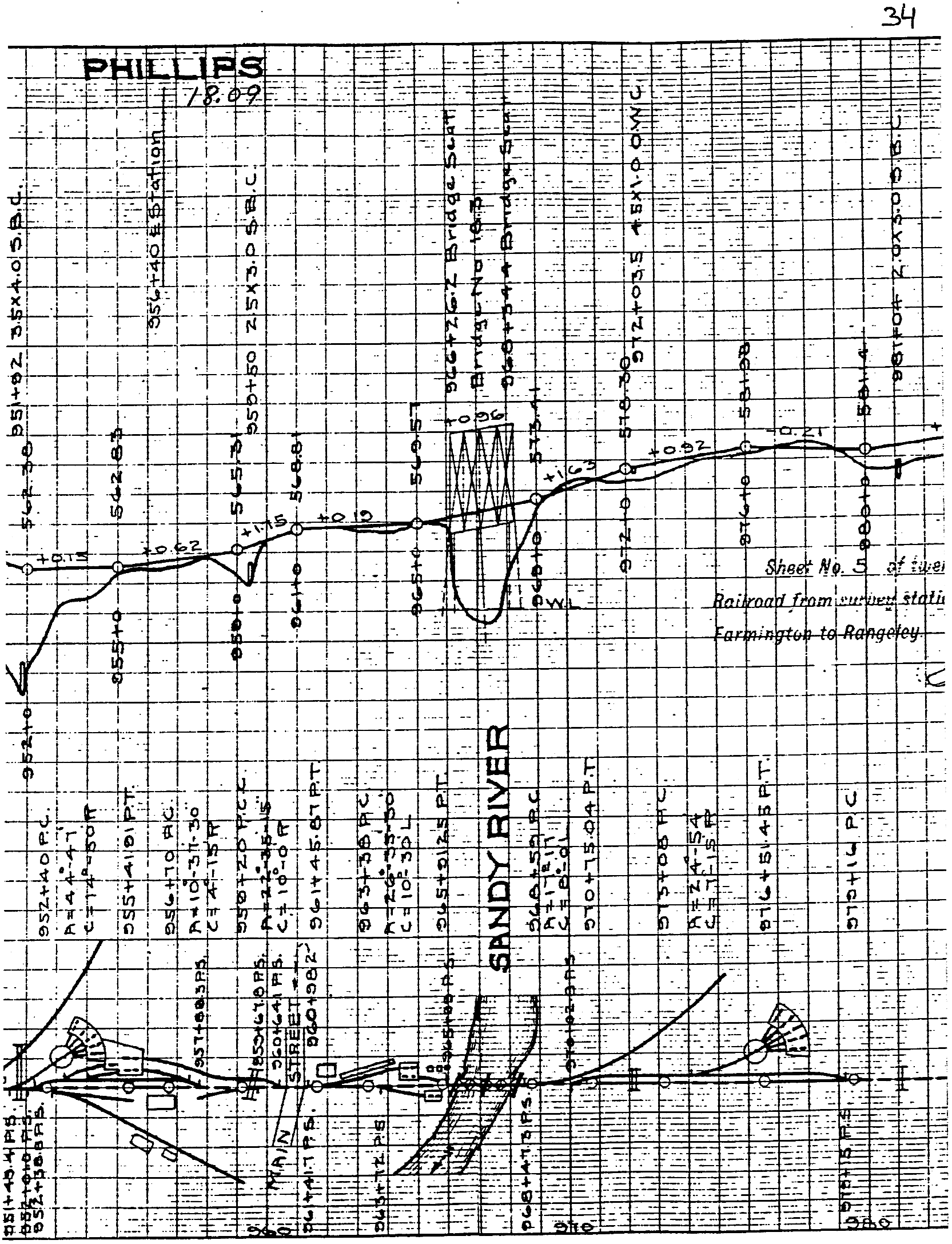
NEW FOR REVISION 2 - Track charts for the entire Sandy River & Rangely Lakes Railroad. This was the largest of the Maine two-foot gauge railroad systems. Having the entire system represented is just fantastic!!! Almost 200 new images!
![]()
This is the FINAL REVISION for TC-13.
Over 900 Valuation Map images!
Over 800 new additions to track charts!
NMRO is offering ONE (1) compact disk containing over 1500 images of land valuation maps and track charts.
If you were to try to obtain these maps anywhere else in paper form it would cost you THOUSANDS of dollars!!! NMRO Products proudly believes that railroad information should be shared as reasonably as possible. Clarification: The data is FREE because it is public domain. NMRO just does the legwork for you!
![]()
Sandy River & Rangely Lakes Railroad sample:
Rutland Railroad sample:
Boston & Maine - Northern RR sample:
Clarendon & Pittsford RR sample:
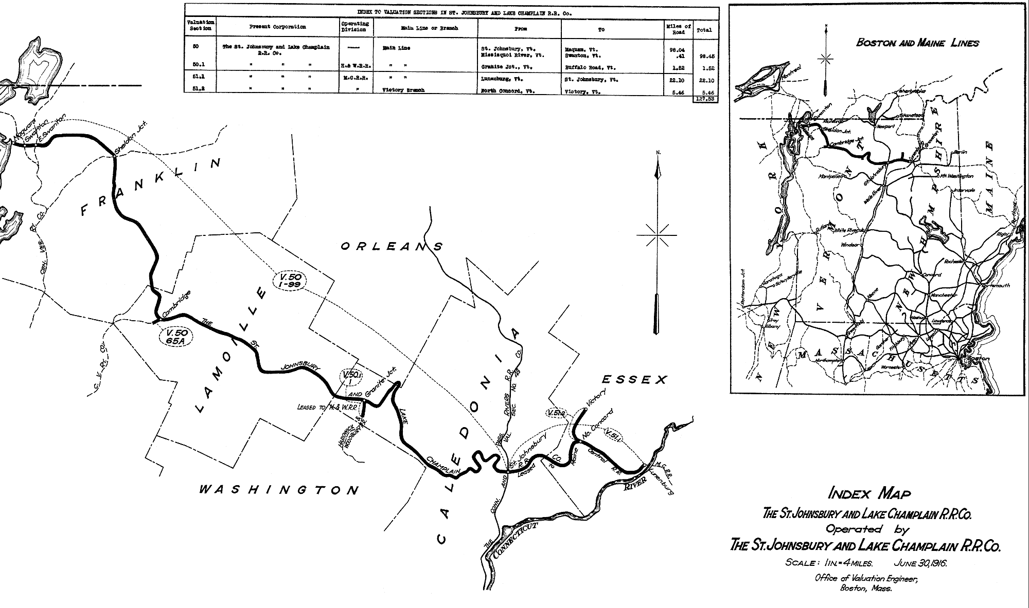
St. J&LC RR sample:
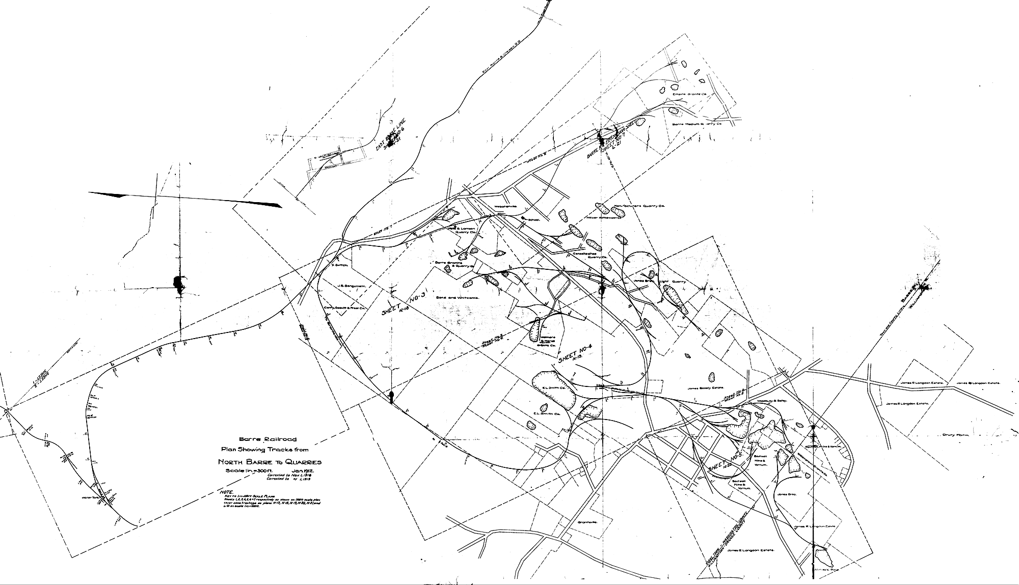
Barre & Chelsea Granite District Sample:
Key Map showing lines covered on this CD :

Order your copy today by mailing $10 + $2 postage to:
Scott J. Whitney
78 Goret Dr.
Colorado Springs, CO 80911
NOTE 1: International mail orders must include $4 additional postage to Canada & Mexico, Total postage $6.
(NOTE 2: ALL International mail orders outside North America must be by Dropbox download only.)
Or use the handy PayPal links below:
![]()
