 Track Charts - Volume 15*
Tennessee Railroad Land Valuation Maps
 1950+ maps covering nearly the entire state!!
*Now available as a direct download via Dropbox! See main NMRO Products page for details.
Once again NMRO Products is again able to offer another massive amount of railroad Land Valuation Maps. Featured in this release are maps covering nearly the entire State of Tennessee and what today are railroads such as CSXT, NS, IC and UP. The former railroads covered are: Southern, Louisville & Nashville, Tennessee Central, Nashville Chattanooga & St. Louis, Clinchfield, Illinois Central, Gulf Mobile & Ohio, and Central of Georgia.
The maps are from many different time periods over the life of the railroad. Most are of fair to very good quality and easy to read. Please refer to the release key maps below and note that this collection is so large that it is divided into three regions accross the State. Thusly, this release is a THREE-disc set when ordering the CD version and is the first NMRO multi-disc collection. Dropbox ordering is easy as all files are in one folder for direct download.
In all, there are over 1950 new maps, and in most areas each covering 2 miles of railroad trackage.
Most all maps are between 7750 and 7900 pixels wide and have been painstakingly enhanced from their original scans for better viewing and printing conditions. It is a pleasure to now offer this collection for the true railfan.
Please note: Because this is a three-disc set, there is a slightly higher price for the materials and the P&H!
There is NO PRICE INCREASE for Dropbox ordering! Still the low $10 NMRO Products price! 
![]()
This is the first edition for TC-15.
Over 1950 images!
NMRO is offering ONE (1) compact disc containing over 1950+ images of land valuation maps.
Resolution of all images is mostly 7750-7900 pixels wide. If you were to try to obtain these maps anywhere else in paper form it would cost you THOUSANDS of dollars!!! NMRO Products proudly believes that railroad information should be shared as reasonably as possible. Clarification: The data is FREE because it is public domain. NMRO just does the legwork and production for you.
![]()
Complete TN coverage map for Dropbox orders ONLY:
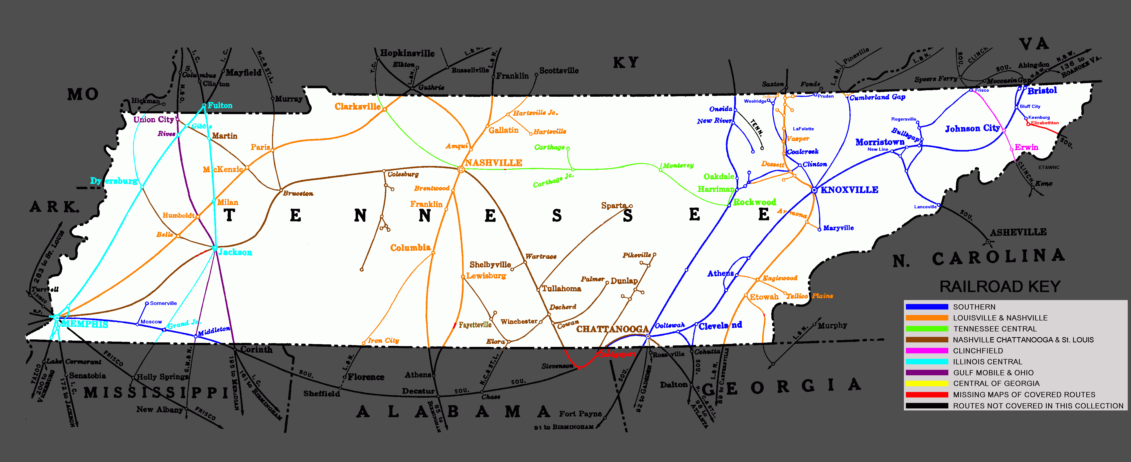
Right click and save image to see it in full size for easier reading.
![]()
Western TN coverage map for disc orders ONLY:
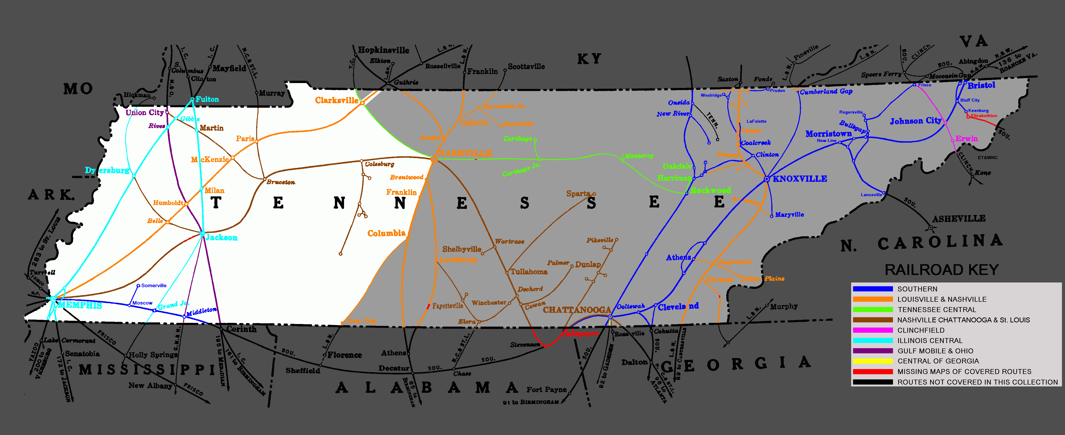
Right click and save image to see it in full size for easier reading.
![]()
Central TN coverage map for disc orders ONLY:
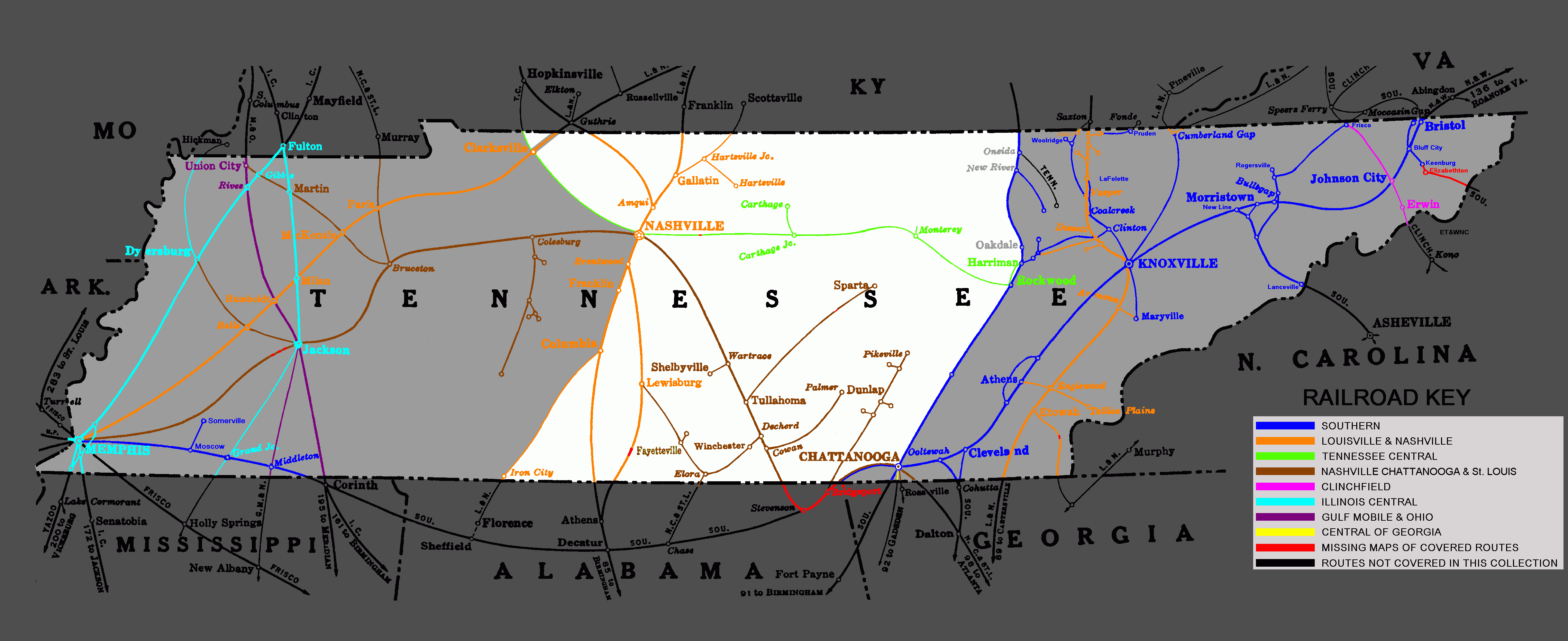
Right click and save image to see it in full size for easier reading.
![]()
Eastern TN coverage map for disc orders ONLY:
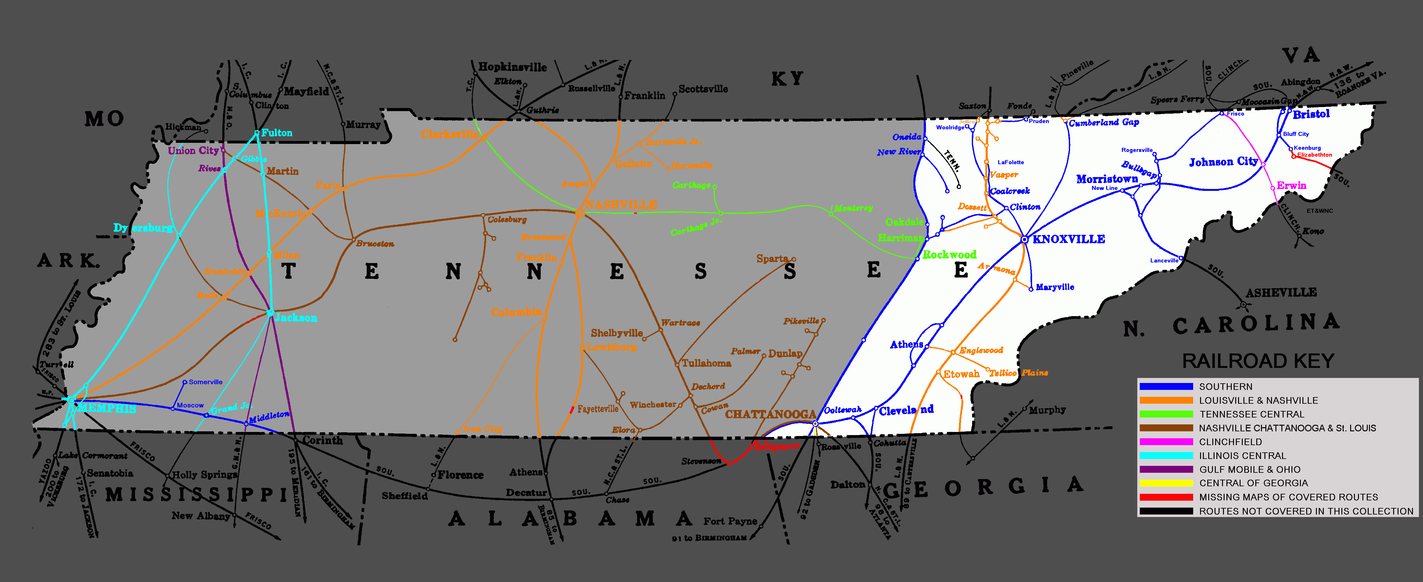
Right click and save image to see it in full size for easier reading.
![]()
Order your copy today by mailing $15 + $3 postage to:
Scott J. Whitney
78 Goret Dr.
Colorado Springs, CO 80911
NOTE 1: International mail orders must include $4 additional postage to Canada & Mexico, Total postage $6.
(NOTE 2: ALL International mail orders outside North America must be by Dropbox download only.)
Or use the handy PayPal links below:
![]()
