>>>FINAL REVISION!<<<
Over 2500 additional images!!
![]()
Track Charts - Volume 6 - Rev. 2 - $10*
Eastern Railroads Part 2
Land Valuation Maps and Data Charts
*Now available as a direct download via Dropbox®! See main NMRO Products page for details.
Thanks to the efforts of a few wonderful individuals, we are again able to offer another great collection of railroad Land Valuation Maps and other highly valuable railroad data. Especially interesting in this release are the Boston & Maine Railroad "N-Plans" which show the signaling details at all of the B&M's interlockings from years past. These include everything from ball signal protected crossings to the most complex interlockings. Many have several release editions that show changes made over the years. The remainder of the collection consists mostly of material as shown below.
Since the release of the original disk, many more donations have come in from various sources. This has allowed Volume 6 to be filled up on its first and only revision with over 2500 additional images. See the list below for the most recent additions and sample images. Keep in mind that this is the ONLY revision, which will be made to this volume.
![]()
NMRO is offering ONE (1) compact disk containing over 1000 images of land valuation map and track chart drawings of the:
Boston & Albany Railroad - Valuation Maps in NY & MA;
Boston & Maine Railroad - Valuation Maps in NY - N-Plans systemwide;
Conrail - Track Charts from 1983/84 Mohawk Div. and 1983 Southern Tier;
Fonda Johnstown & Gloversville Railroad - Valuation Maps (astounding detail!);
Lehigh & Hudson River Railroad - Valuation Maps in NY and NJ;
New York, Westchester & Boston - A partial collection of Valuation Maps;
Rutland Railroad - Valuation Maps for all NY properties.
New material consists of the following:
B&M RR - 1927 Condensed Profiles between Brattleboro and Windsor, VT (prior to extensive rebuilding)
B&M RR - Detour Charts (shows all available detours in case of mainline disruptions);
B&M - Land Valuation Maps for the White Mt Div., Concord to Lincoln, NH and F&T Branch;
B&M - Land Valuation Maps for the Connecticut and Passumpsic Division, White River Jct. to Newport, VT;
Canadian National - Champlain Region Track Plans (includes all CV, GT and CN locations both in New England and north of the border);
Central Vermont, Montpelier & Wells River and Barre & Chelsea - Detailed track maps all around the capitol region of Vermont (OUTSTANDING!);
Central Vermont - 1967 Track Plans (different from those of the CN Champlain Region);
Rutland RR - Bellows Falls Subdivision Land Valuation Maps.
New Haven RR - 1971 Track Diagrams for various main routes;
New Haven RR - 1960 Track Charts for many lines all across the system not covered previously;
New Haven Railroad - Historic interlocking track and signal diagrams (1910-1945);
Pennsylvania RR - Condensed profile for Elmira Branch;
Unadilla Valley RR - Land Valuation maps.
Image Details: Most all Land Valuation Maps are 9950 x 4200+/- pixels. A very few are smaller (because they were given to us as smaller images). Resolution of all images is mostly 2 color GIF format. SPECIAL NOTE: Some map files are in PDF format because we lack the capability to extract the images to GIF format. If you have the software to do so, please feel free to assist in the project!
If you were to try to obtain these maps anywhere else in paper form it would cost you THOUSANDS of dollars!!! NMRO Products proudly believes that railroad information should be shared as reasonably as possible. Clarification: The data is FREE because it is public domain. NMRO just does the leg work for you.
![]()
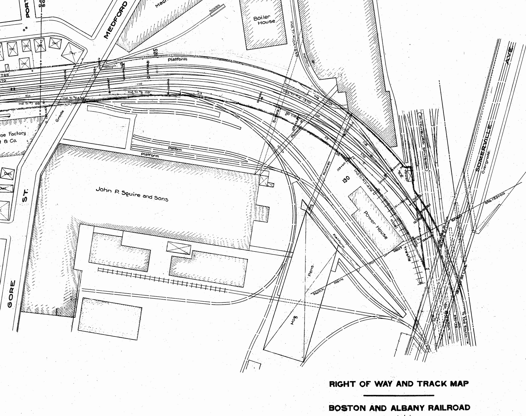
Portion of Boston & Albany - Grand Junction Branch
(right click on images and open larger version in a new tab)
Fonda Johnstown & Gloversville Map Sample

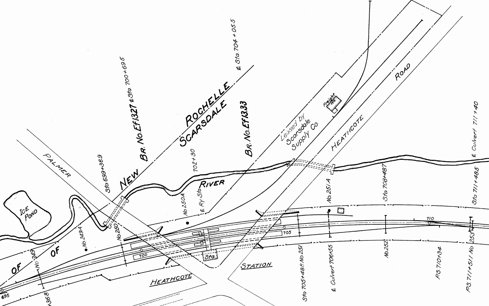
New York Westchester & Boston Valuation Map Sample
Rutland Railroad Valuation Map Sample

Boston & Maine Railroad Valuation Map Sample

Boston & Maine Railroad N-Plan Sample

New Material Samples:
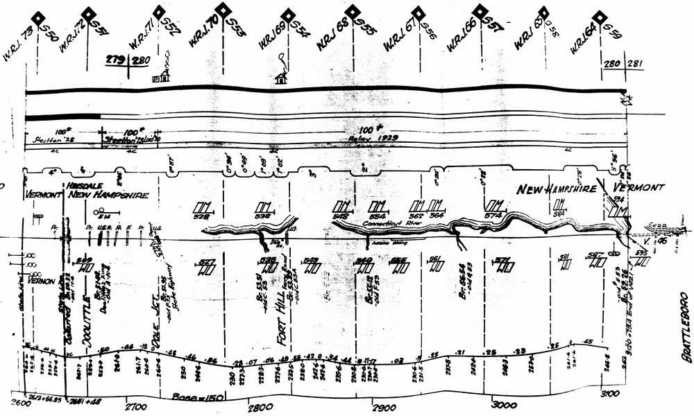
Boston & Maine -Connecticut River Route Profile Sample
Barre, VT - Track & Land Map Sample

New Haven RR - Interlocking Diagram Sample

Order your copy today by mailing $10 + $2 postage to:
Scott J. Whitney
78 Goret Dr.
Colorado Springs, CO 80911
NOTE 1: International mail orders must include $4 additional postage to Canada & Mexico, Total postage $6.
(NOTE 2: ALL International mail orders outside North America must be by Dropbox download only.)
Or use the handy PayPal links below:
![]()
